
Orange County ZIP Code Directory Coverage
Orange County ZIP geography is best read as a set of principal postal areas. The working table below groups the ranges documented in the research. It does not claim that a number reaches every address in a named place. PO-box, unique-code, boundary, and delivery changes require an address-level USPS check before a result is treated as current.
| ZIP(s) | Areas Covered | Post Office | Notes |
|---|---|---|---|
| 90620-90623 | Buena Park, La Palma, Cypress | USPS assignment | Northwestern county; borders Los Angeles County |
| 90630 | Cypress | USPS assignment | Standard Cypress delivery area |
| 90631 | La Habra | USPS assignment | Portions approach county line |
| 90680 | Stanton | USPS assignment | Stanton postal area |
| 90720-90721 | Los Alamitos | USPS assignment | Nearby county and unincorporated delivery patterns; 90721 commonly PO-box use |
| 90740, 90742-90743 | Seal Beach, Sunset Beach, Surfside | USPS assignment | Coastal and PO-box or special-delivery distinctions require USPS check |
| 92602-92604, 92606, 92612, 92614, 92617-92618, 92620 | Irvine | USPS assignment | Multiple planned-community and university or business delivery zones |
| 92610 | Foothill Ranch | USPS assignment | Now City of Lake Forest postal community |
| 92624, 92629 | Capistrano Beach, Dana Point | USPS assignment | 92624 postal identity differs from incorporated city label |
| 92625-92627 | Corona del Mar, Costa Mesa | USPS assignment | 92625 uses Corona del Mar postal name within Newport Beach; 92627 Costa Mesa |
| 92630 | Lake Forest | USPS assignment | Includes Lake Forest postal area |
| 92637 | Laguna Woods | USPS assignment | Retirement community postal area |
| 92646-92649 | Huntington Beach | USPS assignment | West, central, and north Huntington Beach delivery zones |
| 92651-92653 | Laguna Beach, Laguna Hills | USPS assignment | City-specific coastal and interior ZIPs |
| 92655 | Midway City | USPS assignment | Unincorporated CDP, not an incorporated city |
| 92656 | Aliso Viejo | USPS assignment | Standard Aliso Viejo area |
| 92657, 92660-92663 | Newport Coast, Newport Beach | USPS assignment | Newport Coast postal area and Newport Beach zones |
| 92672-92675 | San Clemente, San Juan Capistrano | USPS assignment | South county; special and PO-box status should be verified |
| 92676 | Silverado | USPS assignment | Unincorporated canyon community |
| 92677 | Laguna Niguel | USPS assignment | Also used in nearby coastal and interior routing contexts |
| 92679 | Trabuco Canyon, Coto de Caza, Wagon Wheel | USPS assignment | Postal area spans unincorporated and master-planned communities |
| 92683 | Westminster | USPS assignment | Little Saigon and core Westminster postal area |
| 92688 | Rancho Santa Margarita | USPS assignment | Planned-city postal area |
| 92691-92692 | Mission Viejo | USPS assignment | Primary Mission Viejo zones |
| 92694 | Ladera Ranch, Rancho Mission Viejo | USPS assignment | Large master-planned and unincorporated delivery geography |
| 92701-92708 | Santa Ana, Fountain Valley | USPS assignment | 92701-92707 Santa Ana patterns; 92708 Fountain Valley; special codes omitted pending USPS check |
| 92780, 92782 | Tustin | USPS assignment | Tustin, legacy, and newer planned-area zones |
| 92801-92808 | Anaheim | USPS assignment | Western, central, and eastern Anaheim; resort and hill areas span several codes |
| 92821-92823 | Brea | USPS assignment | 92823 includes eastern and hill development |
| 92831-92833, 92835 | Fullerton | USPS assignment | Fullerton zones |
| 92840-92845 | Garden Grove | USPS assignment | Garden Grove and West Garden Grove delivery areas |
| 92861-92869 | Villa Park, Orange | USPS assignment | 92861 Villa Park; 92862 special; 92863-92869 Orange zones |
| 92870 | Placentia | USPS assignment | Placentia postal area |
| 92886-92887 | Yorba Linda | USPS assignment | Western and eastern Yorba Linda |
The table is a discovery aid. It is not a claim that every ZIP in a group has one post-office counter, one city boundary, or one resident record source. Verify the complete address before moving to a parcel search.
Orange County ZIP Geography
A ZIP is assigned for mail delivery. It is not a legal county or city boundary. Orange County has 34 incorporated cities plus unincorporated communities, so a postal city can point to a different government office than the mailing label suggests. City planning, building, and public works offices handle addresses inside cities. County public works and GIS handle unincorporated land. USPS controls delivery names and ZIP placement.
That split matters in a postal directory. An address in a familiar postal place may belong to a city clerk, county department, or another local custodian. Annexation can change the government record path without immediately changing the postal city. Use the ZIP to narrow a search, then use GIS to decide which jurisdiction owns the next record.
North Tustin, Rossmoor, Midway City, Silverado, Williams Canyon, Modjeska, Trabuco Canyon, Las Flores, Coto de Caza, Ladera Ranch, and Rancho Mission Viejo are examples of unincorporated or mixed postal geography in the research. A name on the envelope cannot settle that question.
Note: A ZIP code is a delivery geography, so its boundary can cross city lines and does not define an Orange County neighborhood.
Orange County Irvine ZIPs
Irvine is a clear Orange County postal example because its delivery geography is spread across several codes. The documented Irvine group includes 92602-92604, 92606, 92612, 92614, 92617-92618, and 92620. Planned communities, university areas, and business zones can carry different postal routes even when a searcher thinks of them as one city.
A postal-directory entry should therefore keep the full address, not just “Irvine.” Verify the address in USPS, then use OC GIS for the parcel and jurisdiction. The same process works in larger city groups such as Anaheim, Fullerton, Huntington Beach, and Santa Ana, where several codes reflect delivery zones rather than a list of residents.
Do not turn a ZIP range into a claim that every listed place has the same assessor, permit, or tax-search path. Postal geography is the first filter. Parcel geography supplies the next one.
Search Orange County by ZIP Code
Finding a person or parcel by ZIP takes a short chain. The Orange County ZIP code directory can validate a known address, but a ZIP-wide search cannot supply a complete occupant list, and the voter file is not an open block directory. Use a ZIP as a discovery step, then narrow to a parcel and source custodian.
- Enter the exact address in USPS and save the returned ZIP and postal-city convention.
- Open the county parcel layer and use GIS to check the jurisdiction, parcel shape, and APN.
- Carry the APN to the Assessor or Treasurer-Tax Collector search for assessment or tax status.
- Use the owner name from the parcel record, where lawfully shown, in the recorded-document index.
- For voter data, use self-lookup for the voter or the OC Vote application only when an approved purpose supports the request.
Once a ZIP has narrowed the address, the Orange County street directory route handles the street-level parcel chain. The ZIP remains a delivery clue, not a substitute for the APN or legal description.
Orange County USPS Lookup Fields
The USPS lookup should answer a narrow question: how does the delivery system recognize this address? The research does not support a fixed list of live field labels, so the useful field map stays modest. Record what the portal returns, including a changed postal city, a PO-box or special code indication, and the exact street or unit form.
| Search item | Use in the ZIP code directory | Do not infer |
|---|---|---|
| Street address | Verify the delivery ZIP and postal-city wording | Municipal limits or occupants |
| City or place label | Spot a postal name that differs from the city line | Which clerk holds every local record |
| ZIP result | Choose the parcel and tax follow-up area | A complete resident or voter list |
| PO-box or unique-code indication | Flag a special delivery pattern for closer checking | That a code serves all nearby street addresses |
View the USPS ZIP Code Lookup and the USPS ZIP-code guidance before treating a directory grouping as current.
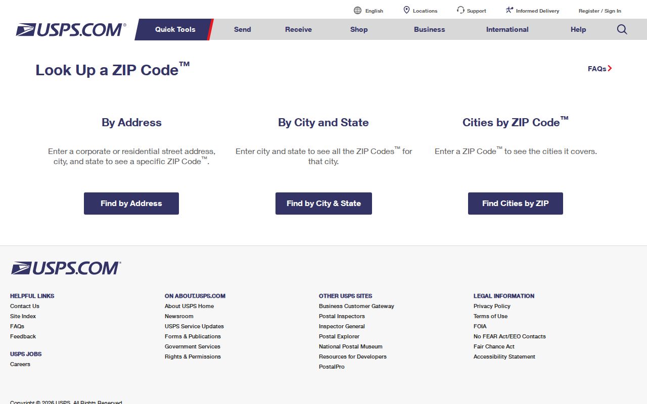
The USPS lookup view belongs at the start of the chain because a valid ZIP is an address-level result, not a county-wide boundary promise.
Note: USPS confirms mailing terminology and ZIP assignment; parcel boundaries and local record custody require a separate Orange County check.
Orange County ZIP City Lines
Postal labels and city limits diverge in several Orange County examples. Corona del Mar uses 92625 within Newport Beach. Capistrano Beach uses 92624 while the incorporated city label may point elsewhere. Midway City uses 92655 but is an unincorporated census-designated place. Silverado uses 92676 and is an unincorporated canyon community. The delivery label is useful, but the records office follows jurisdiction.
- ZIP code
- A five-digit USPS delivery area used to sort mail, not a legal boundary.
- ZIP+4
- A more precise postal extension added to a five-digit ZIP for delivery sorting.
- PO-box ZIP
- A code or pattern used for post-office-box or special delivery service that needs address-level verification.
- Unique ZIP
- A special USPS code associated with one institution or organization rather than a normal neighborhood grid.
- Carrier route
- A delivery route grouping that is finer than a county or city boundary and does not identify residents.
These terms help explain why a postal directory can organize a search without defining the parcel, the city, or the people associated with it.
Orange County Unincorporated ZIPs
The 92679 group reaches Trabuco Canyon, Coto de Caza, and Wagon Wheel. The 92694 group reaches Ladera Ranch and Rancho Mission Viejo. Those labels describe a postal and planned-community geography that can require county records rather than a city office. A ZIP code search that stops at the place name may send a request to the wrong custodian.
Other unincorporated examples include North Tustin, Rossmoor, Midway City, Silverado, Williams Canyon, Modjeska, Las Flores, and parts of Trabuco Canyon. OC GIS helps separate the census-place or postal label from the parcel’s government jurisdiction. County public works covers unincorporated land, while a city department handles its own address, permit, planning, or code records.
Use the USPS result to preserve the mailing convention. Use GIS to preserve the jurisdiction. Both pieces belong in a careful Orange County postal-directory note.
Note: An unincorporated postal place may sit outside a city government while remaining inside Orange County's assessor and records geography.
From ZIP Code to Orange County APN
The APN is the bridge from postal discovery to land records. The Orange County Assessor sends users to ParcelQuest for property information and parcel maps, while the county parcel service supplies geometry. The Treasurer-Tax Collector offers a current secured-property-tax inquiry. None of these sources should be read as an unrestricted list of occupants.
Use the Assessor’s property and parcel-map route for the address or APN path, then open the OC GIS parcel service to check the shape and nearby jurisdiction. The Treasurer-Tax Collector tax search can supply a tax-status link. Carry the APN and legal description into a deed search when ownership history is the question.
This ZIP to USPS to GIS to APN to owner or deed chain is more stable than a place name. An Orange County ZIP code directory note should preserve the mailing address, owner display, or tax record date and legal limit. The chain should say what each source proves.
Orange County Scale and ZIP Context
ZIP geography feels simple until the county’s scale is visible. Census QuickFacts reports 3,186,989 Orange County residents in 2020, a 2025 estimate of 3,149,507, 1,167,032 residential units, and 1,082,960 households for 2020 through 2024. Those figures describe the county as a whole. They do not turn a ZIP into a current headcount or a public resident roll.
Population, unit, language, and business measures can help frame why an Orange County postal directory needs a precise address. Irvine’s planned zones, the coastal postal identities, the north county border, and the canyon communities all use different record paths. The scale also makes a common name or broad ZIP result a poor identity match without a parcel, date, or source custodian.
See the Census QuickFacts context for Orange County when a county-level number is needed.
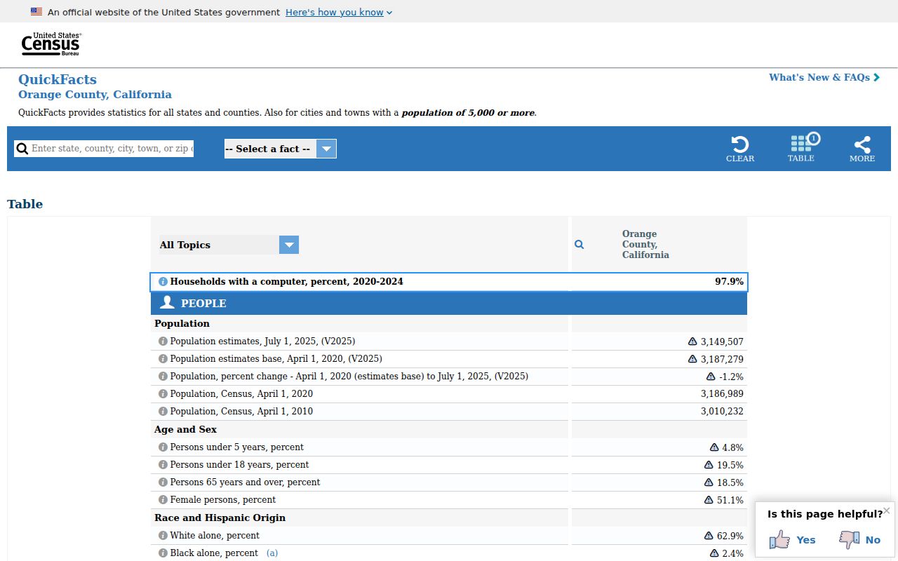
The Census image adds scale to the postal map, while USPS and parcel records handle the address-level question.
Orange County ZIP Resident Limits
A ZIP does not contain a public list of every person at every address. The property roll can omit or suppress information, and it describes ownership or assessment clues. The voter file is controlled by Elections Code section 2194 and related regulations. My Voter Status is a self-lookup. Full voter data needs an approved election, scholarly, journalistic, political, or governmental purpose, a signed application, support, identification where required, and payment through the documented route. Personal or casual block use is not a workaround.
Household members, non-owner occupants, utility customers, delivery recipients, and protected participants may not appear in a lawful public source. A postal directory should therefore help verify a known address, not invite a broad hunt for names. Save only the smallest record set needed for a family, estate, parcel, or civic question.
Lawful use. ZIP research is for personal, lawful purposes and careful address verification. Do not use a postal area to stalk, harass, or intimidate a person, and do not treat an owner or voter clue as proof of occupancy.
Note: A USPS match settles delivery wording, not the city line, parcel owner, household, or current resident.